| # |
| 1 | Alexandria  | Urban Areas | Communities |
|
Alexandria
Neighborhood that Rick and his friends join beginning in Season 5.
 
|
| 2 | Alexandria Safe-Zone  | Urban Areas | Communities |
|
Alexandria Safe-Zone
Well-protected settlement where Rick and his friends reside.
|
| 3 | Arbor Trail | Transit Routes | Streets-misc |
|
Arbor Trail
Address of Vincent's Fine Wines, the abandoned store that Carol visits (Arbor Trail in Dover Hills, Ohio).

|
| 4 | Bear Creek | Water | Creeks |
|
Bear Creek
Creek on the map showing the critical intersection of Marshall Road and Redding Road, where the residents of Alexandria attempt to divert a horde.

|
| 5 | Birch Street | Transit Routes | Streets |
|
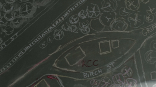
Birch Street
Street on Morgan's map of the town.
|
| 6 | Branton Road | Transit Routes | Streets-Roads |
|
Branton Road
Road that Deanna mentions - where she tells Rick to dump Pete Anderson's body.

|
| 7 | Broad Street [Alexandria] | Transit Routes | Streets |
|
Broad Street [Alexandria]
Street sign visible behind Rick as he weaves through walkers to get back to Alexandria.
|
| 8 | Broad Street [King County] | Transit Routes | Streets |
|
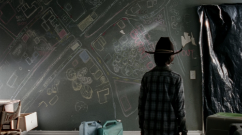
Broad Street [King County]
Street on Morgan's map of Rick's home town.
|
| 9 | Burke Road | Transit Routes | Streets-Roads |
|
Burke Road
Address of Paze Industrial Research, one of the Savior lookout posts.

|
| 10 | Burke's Pass | Transit Routes | Streets-misc |
|
Burke's Pass
Trail mentioned.
|
| 11 | Christopher | Urban Areas | Cities-U.S. |
|
Christopher
Town that Rick mentions: If Sophia kept in that direction, she might have gotten out of the forest and into the farmland. So we take 74 up to Ivy Road, then push down South on foot through the forest till we hit Christopher, go east a couple of miles and then double back.
|
| 12 | Coalport | Urban Areas | Neighborhoods |
|
Coalport
Community that Magna's group came from, which was located near the ocean.
|
| 13 | The Commonwealth | Urban Areas | Communities |
|
The Commonwealth
Walled city from multiple episodes.
 

|
| 14 | Crook Road | Transit Routes | Streets-Roads |
|
Crook Road
Road that Abraham's truck passes.

|
| 15 | Crooks | Transit Routes | Streets-misc |
|
Crooks
Road mentioned by Commonwealth Outpost 22 soldier on radio giving directions: Gauge your direction, and head south. Copy so far? Eventually you'll hit Highway 30. Take it east. Get off at Crooks.
|
| 16 | Dawson Highway | Transit Routes | Streets-Ways |
|
Dawson Highway
Location of Savior lookout post on Rick's map.

|
| 17 | Dover Hills, Ohio | Urban Areas | Cities-U.S. |
|
Dover Hills, Ohio
Address of Vincent's Fine Wines, the abandoned store that Carol visits (Arbor Trail in Dover Hills, Ohio).

|
| 18 | Dufresne County  | Geographic Areas | Counties |
|
Dufresne County
Street sign referencing Andy Dufresne from Stephen King's Shawshank Redemption, which original Walking Dead showrunner Frank Darabont also directed.

|
| 19 | Dylan Drive | Transit Routes | Streets-Drives |
|
Dylan Drive
Road Rick mentions: Did you ever hear about the time Shane stole Kingsley's car? The Principal's car right out of the teacher's lot in the middle of a school day. Shane steps out of lunch and makes a beeline to Kingsley's Hyundai. Wires the ignition, peels out, drives down Dylan Drive to that chicken farm out there. You've heard this before, right? So he pulls it into one of the big holding pens. Kingsley, he waxed that thing every month. Had the auto shop vacuum it out every week. Shane, he parks it in this huge pen with a couple of hundred Rhode Island reds. He busts open bags of seed in the back seat, rolls down all the windows, and then starts sprinting back to school. It's three miles away easy. He's back in time to finish his sandwich before the bell. And then the bell rings. Shane gets up and when he runs into Kingsley in the hallway he looks out the window and says, Principal Kingsley, your coupe's gone. Coupe, like chicken coop.

|
| 20 | Edgehill Parkway | Transit Routes | Streets-Ways |
|
Edgehill Parkway
Road that Alden mentions to Rick: There's an old dive bar three miles off Edgehill Parkway. Some of them, uh, took me there once. They wanted my expert opinion on what it'd take to turn the place into an outpost. It's between here and there, but the chances they'd actually go...
|
| 21 | Elders Mill Road | Transit Routes | Streets-Roads |
|
Elders Mill Road
Where the group camps after Hershel's farm is destroyed.
|
| 22 | The Estates | Urban Areas | Neighborhoods |
|
The Estates
Neighborhood in the Commonwealth where the rich people live.

|
| 23 | Fairburn Road | Transit Routes | Streets-Roads |
|
Fairburn Road
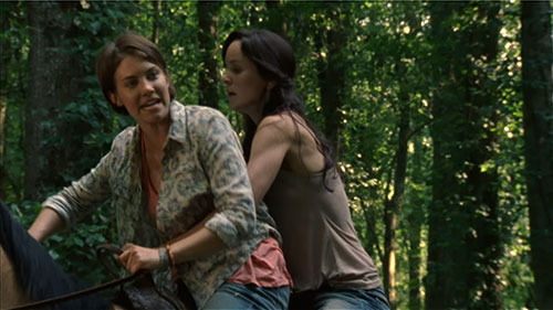
Road Maggie mentions: Rick sent me. You've got to come now. There's been an accident. Carl's been shot. He's still alive, but you've gotta come now. Rick needs you. Just come! Rick said you had others on the highway, that big traffic snarl? Backtrack to Fairburn Road. Two miles down is our farm. You'll see the mailbox. Name's Greene.
|
| 24 | Falls Church | Structures | Churches |
|
Falls Church
Church that Dianne and Ezekiel discuss, where Alfred is heading.
|
| 25 | Farmview Road | Transit Routes | Streets-Roads |
|
Farmview Road
Dwight mentions: We opened the valve and drove all the way in from Farmview Road. Ran from the tree line till we got to the pavement. Lit up a matchbook from the Sweetwater and dropped it in on the trail.
|
| 26 | First Christian Church of Commonwealth | Structures | Churches |
|
First Christian Church of Commonwealth
Church in the Commonwealth where Ezekiel preaches.

|
| 27 | Fleetwood Drive | Transit Routes | Streets-Drives |
|
Fleetwood Drive
Street sign that Eugene notices, making him realize that Princess has led them in a circle.

|
| 28 | Foreston Place | Transit Routes | Streets-Places |
|
Foreston Place
Street in the grouping of suburbs where the gang takes Noah back to his old house.
|
| 29 | Grace Baptist Church | Structures | Churches |
|
Grace Baptist Church
Church where Ezekiel's mother was a Sunday school teacher.
|
| 30 | Grant Street | Transit Routes | Streets |
|
Grant Street
Street on Morgan's map of the town.

|
| 31 | Griffin Street | Transit Routes | Streets |
|
Griffin Street
Street on Morgan's map of the town.

|
| 32 | Heaven | Worlds | Afterlife |
|
Heaven
Mentioned in multiple episodes.
|
| 33 | Hell | Worlds | Afterlife |
|
Hell
Carol: I don't know if I believe in God anymore or heaven, but if I'm going to hell, I'm making damn sure I'm holding it off as long as I can.
|
| 34 | Highway 30 | Transit Routes | Streets-Ways |
|
Highway 30
Road mentioned by Commonwealth Outpost 22 soldier on radio giving directions: Gauge your direction, and head south. Copy so far? Eventually you'll hit Highway 30. Take it east. Get off at Crooks.
|
| 35 | Hilltop Colony | Urban Areas | Neighborhoods |
|
Hilltop Colony
Jesus's community.
|
| 36 | Holy Cross Lutheran Church | Structures | Churches |
|
Holy Cross Lutheran Church
Van visible at the survivor camp.

|
| 37 | Ivy Road | Transit Routes | Streets-Roads |
|
Ivy Road
Road that Rick mentions: If Sophia kept in that direction, she might have gotten out of the forest and into the farmland. So we take 74 up to Ivy Road, then push down South on foot through the forest till we hit Christopher, go east a couple of miles and then double back.
|
| 38 | Jefferson Avenue | Transit Routes | Streets-Avenues |
|
Jefferson Avenue
Road near the Alexandria settlement.
|
| 39 | Jones Springs | Urban Areas | Neighborhoods |
|
Jones Springs
Community where Magna's group used to live.
|
| 40 | King County, Georgia | Geographic Areas | Counties |
|
King County, Georgia
Where the Grimes family is from.

|
| 41 | The Kingdom | Urban Areas | Communities |
|
The Kingdom
Walled community in Arlington County, Virginia, led by King Ezekiel.
|
| 42 | Kraftwood Park | Urban Areas | Neighborhoods |
|
Kraftwood Park
Neighborhood in the grouping of suburbs where the gang takes Noah back to his old house.
|
| 43 | La Grange Street | Transit Routes | Streets |
|
La Grange Street
Street on Morgan's map of the town.

|
| 44 | Linden County, Georgia | Geographic Areas | Counties |
|
Linden County, Georgia
Setting. Where Rick's family lived before the zombie apocalypse.
|
| 45 | Lindor Street | Transit Routes | Streets |
|
Lindor Street
Address of a delivery listed on the receipt that Carol finds in Vincent's Fine Wines store (Lindor Street in Port Springs, Ohio).

|
| 46 | Linus Overpass | Transit Routes | Streets |
|
Linus Overpass
Road Gabriel mentions when Dr. Carson asks if he has any idea where they are: Well, that depends. Have we passed the Linus Overpass yet?
|
| 47 | Love Town | Urban Areas | Cities-Joke |
|
Love Town
Joke Eugene makes to Rosita: I don't mean to eat sorrow by the spoonful in front of you, but I'm in the midst of experiencing a crushing moment of clarity. Our whole friendship is premised on my mistaken belief that, perhaps someday, I could change your mind, that you would see that I was worthy enough of being re-zoned into Love Town.
|
| 48 | Main Street [King County] | Transit Routes | Streets |
|
Main Street [King County]
Street in Rick's home town where Rick finds Morgan.

|
| 49 | Main Street [Woodbury] | Transit Routes | Streets |
|
Main Street [Woodbury]
Street in Woodbury.

|
| 50 | Marshall Rd | Transit Routes | Streets-Roads |
|
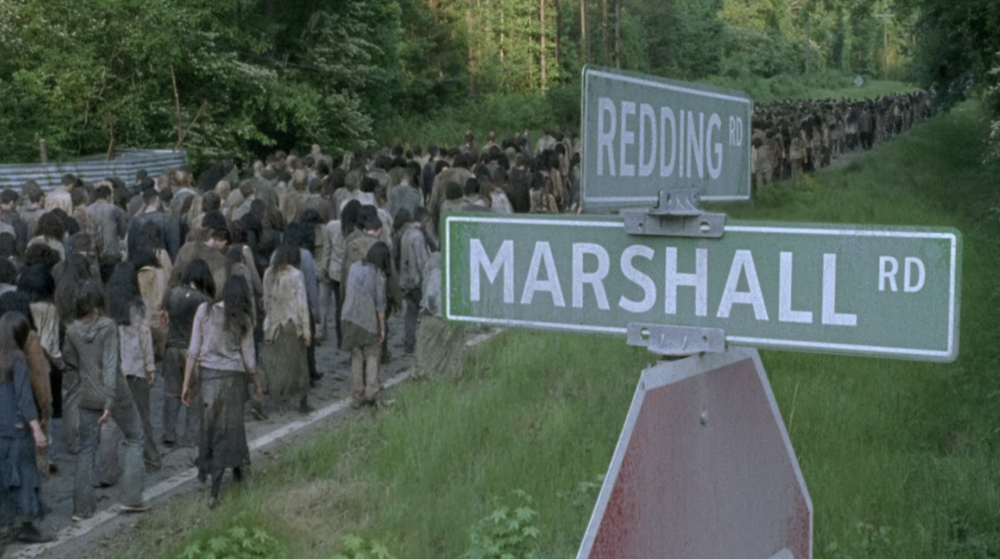
Marshall Rd
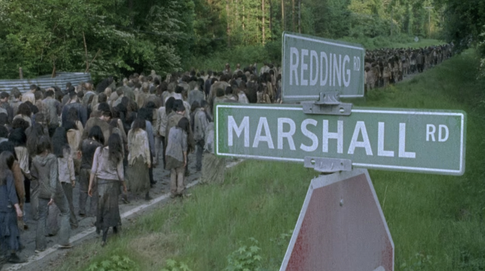
Intersection of Marshall Rd and Redding Rd critical turning point for the herd of walkers.
|
| 51 | Mert County, Georgia | Geographic Areas | Counties |
|
Mert County, Georgia
County in Georgia, location of Hershel's farm.
|
| 52 | Miller Street | Transit Routes | Streets |
|
Miller Street
Rosita's address in the Commonwealth. Mercer mentions during her interrogation.
|
| 53 | Morgan Street | Transit Routes | Streets |
|
Morgan Street
Street in Alexandria that Rosita mentions.
|
| 54 | Moss Road | Transit Routes | Streets-Roads |
|
Moss Road
Road near the critical intersection of Marshall Road and Redding Road, where the residents of Alexandria attempt to divert a horde.

|
| 55 | Oceanside | Urban Areas | Neighborhoods |
|
Oceanside
The name of the community of women that Tara finds - because The Saviors killed all their men.
|
| 56 | Oceanside Cabin Motor Court | Residential Communities | Trailer Parks |
|
Oceanside Cabin Motor Court
Old trailer park from which the community of women that Tara finds takes their name.

|
| 57 | Old Mill Road | Transit Routes | Streets-Roads |
|
Old Mill Road
Road from multiple episodes.

|
| 58 | Outpost 22 | Structures | Military Bases |
|
Outpost 22
Commonwealth processing center and work camp in what used to be Alexandria.

|
| 59 | Packard Avenue | Transit Routes | Streets-Avenues |
|
Packard Avenue
Road mentioned by Commonwealth Outpost 22 soldier on radio giving directions: Head due north through the woods. You'll eventually reach a breach. After that, you'll be on a rough road. That's Packard Avenue.
|
| 60 | Pee-Pee Pants City | Urban Areas | Cities-Joke |
|
Pee-Pee Pants City
Joke Negan makes: It's gonna be Pee-Pee Pants City here real soon.
|
| 61 | Port Springs, Ohio | Urban Areas | Cities-U.S. |
|
Port Springs, Ohio
Address of a delivery listed on the receipt that Carol finds in Vincent's Fine Wines store (Lindor Street in Port Springs, Ohio).

|
| 62 | Redding Rd | Transit Routes | Streets-Roads |
|
Redding Rd
Intersection of Marshall Rd and Redding Rd critical turning point for the herd of walkers.
|
| 63 | Redwine Road | Transit Routes | Streets-Roads |
|
Redwine Road
Street in the grouping of suburbs where the gang takes Noah back to his old house.
|
| 64 | Redwood Park | Transit Routes | Streets-misc |
|
Redwood Park
Street in the grouping of suburbs where the gang takes Noah back to his old house.
|
| 65 | Residential One | Residential Communities | Apartment and Condos |
|
Residential One
Apartment building in the Commonwealth where "Stephanie" lives.
|
| 66 | Reyes Street | Transit Routes | Streets |
|
Reyes Street
Location of Savior lookout post on Rick's map.

|
| 67 | Ridge Road | Transit Routes | Streets-Roads |
|
Ridge Road
Road near the cabin where the gang rides out the storm.
|
| 68 | Riverbend | Urban Areas | Communities |
|
Riverbend
Community mentioned over the PA system at the Commonwealth: The targets are new immigrants from the Virginia communities of Riverbend, Hilltop, and Alexandria. Any known associates of Eugene Porter are to be brought in for questioning regarding the Founders Day riot and the death of Sebastian Milton.
|
| 69 | Route A | Transit Routes | Streets-Routes |
|
Route A
New thoroughfare created by survivors.
|
| 70 | Route B | Transit Routes | Streets-Routes |
|
Route B
New thoroughfare created by survivors.
|
| 71 | Route D | Transit Routes | Streets-Routes |
|
Route D
New thoroughfare created by survivors from various episodes.
|
| 72 | The Sanctuary | Urban Areas | Communities |
|
The Sanctuary
Secured facility in Virginia. Originally a factory, it served as the base of operations for the Saviors, a violent group of extortionists that seized and terrorized various communities to provide for them.

|
| 73 | The Screaming Cave | Nature | Natural Areas |
|
The Screaming Cave
Cave where an ex-Whisperer hiding out at Hilltop tells Aaron and Carol that he saw one of their people - Connie.
|
| 74 | Shirewilt Estates | Urban Areas | Neighborhoods |
|
Shirewilt Estates
Neighborhood in the grouping of suburbs where the gang takes Noah back to his old house.
|
| 75 | Shit Creek | Water | Creeks |
|
Shit Creek
Joke Abraham makes: What it indicates is that we are neck deep up Shit Creek with our mouths wide open.
|
| 76 | Solomon Street | Transit Routes | Streets |
|
Solomon Street
Street in the Commonwealth.

|
| 77 | Southern Baptist Church of Holy Light | Structures | Churches |
|
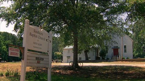
Southern Baptist Church of Holy Light
Church that the group finds while searching for Carol's daughter Sophia.
|
| 78 | St. Sarah's Church | Structures | Churches |
|
St. Sarah's Church
Father Gabriel's church.

|
| 79 | Summer Place | Urban Areas | Neighborhoods |
|
Summer Place
Neighborhood in the grouping of suburbs where the gang takes Noah back to his old house.
|
| 80 | Sweetwater | Urban Areas | Cities-U.S. |
|
Sweetwater
Dwight mentions: We opened the valve and drove all the way in from Farmview Road. Ran from the tree line till we got to the pavement. Lit up a matchbook from the Sweetwater and dropped it in on the trail.
|
| 81 | Terminus | Urban Areas | Cities |
|
Terminus
Old train station used by group of survivors turned cannibals.

|
| 82 | West Georgia Correctional Facility | Detention Centers | Correctional Facilities |
|
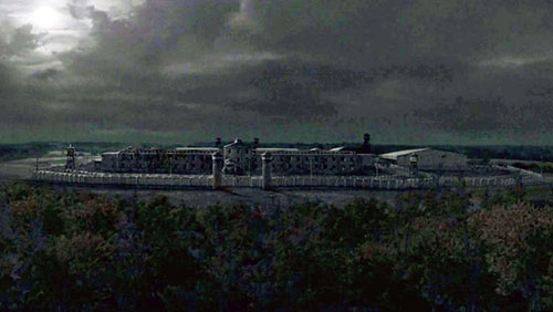
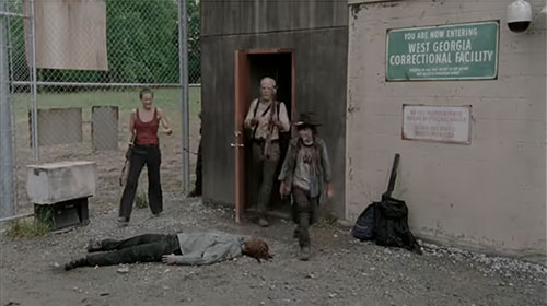
West Georgia Correctional Facility
Prison where Rick's group seeks shelter.
 
|
| 83 | Wiltshire Estates | Urban Areas | Neighborhoods |
|
Wiltshire Estates
Neighborhood where the group goes looking for Sophia.

|
| 84 | Woodbury | Urban Areas | Cities-U.S. |
|
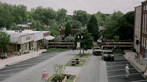
Woodbury
Georgia town, home of the Governor's neighborhood. From multiple Season 3 episodes.
|
| 85 | Yellow Jacket Creek | Water | Creeks |
|
Yellow Jacket Creek
Creek in Georgia where Daryl and Merle Dixon cross a highway bridge and help a Mexican family fight off the walkers surrounding them.
|


